Español
 English
 Français
 Italiano
How to add water stops to a GPX route
If you already have a GPX file for a walk or bike ride, use it to plan where to refill your bottle. AquaFinder shows fountains near the track and lets you add the ones you choose as stops.
Import the GPX file
In AquaFinder’s routes section, choose Import and open the GPX file saved on your phone. Check the track on the map before customising it.
Find fountains near the route
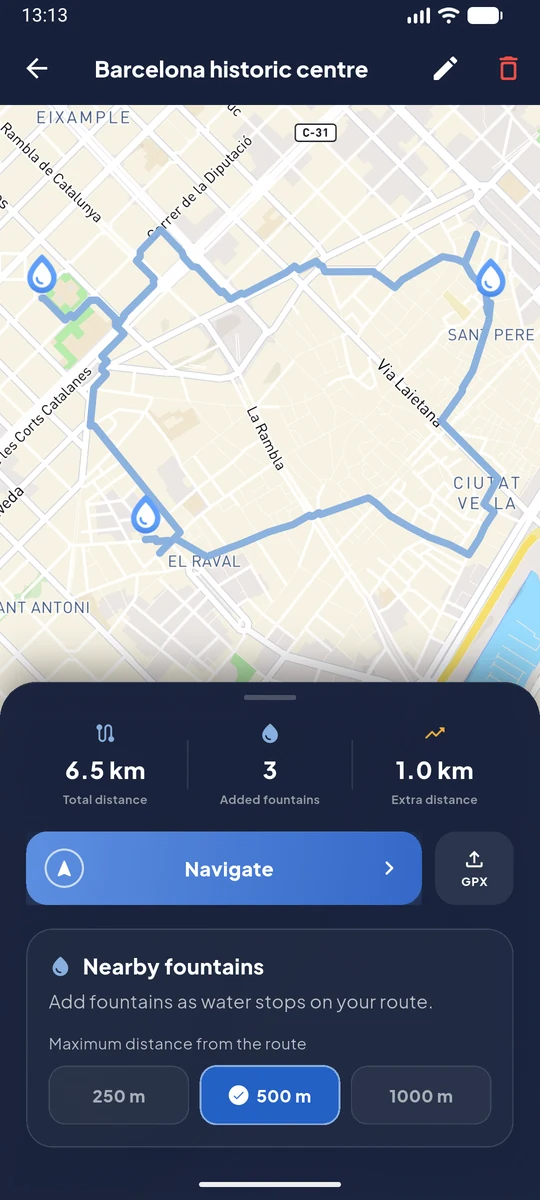
Open Nearby fountains and try a radius of 250, 500 or 1,000 metres. The radius measures distance from the track, which can differ from the distance you travel to reach a fountain. Check photos and recent reports before choosing.
Add stops and export the modified route
Select your fountains, review the detours on the map and save the route. Under Export GPX, choose Modified route to save or share the file with the detours included.
An example with three stops in Barcelona
The screenshot shows an example route through Barcelona’s historic centre. The three selected fountains show how water stops look before export. Check recent reports and local signs before relying on a fountain.